At 19:54 last night (local time) a huge earthquake struck off the coast of Santiago, the Chilean capital. The initial quake was 8.3 on the Richter Scale (
Google Earth file showing intensity map). The focus was10km deep, which is quite close to the surface.
 |
| This diagram shows the intensity of the quake at various locations in Chile. |
Tsunami Warning
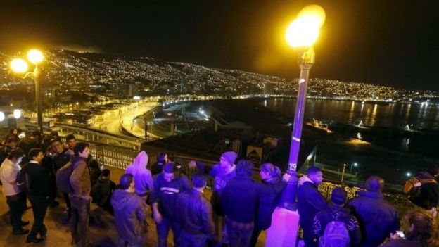
The huge quake produced waves of up to 4.5m along the coast. Over 1 million people were evacuated to high land. This is an amazing number of people and shows how much better informed the population are in coastal earthquake zones and how much better governments are at communicating warnings. A simple blanket SMS message can get information to millions of people almost instantly and when people know what is happening and what they are supposed to do: this reduces panic and minimises the loss of life.
 |
| The port of Valparaiso, people moved to high ground to avoid a potential tsunami |
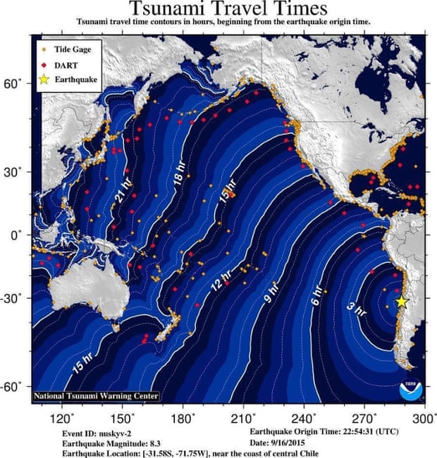
Tsunamis can travel great distances and so much of the Pacific rim has been put on high alert in case a tsunami should come to shore. The map below shows how long the waves would take to cross the ocean.


